


PAAD Software
Procedure Airspace Analysis & Design
Key Benefits
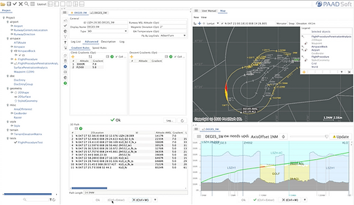
Help Airspace designers interact with IFP designers
-
input / edit Airspace structure
-
sectors, airspace, waypoint, routes, runways etc (AIXM based)
-
edit/create though forms or map click/drag (CAD like)
-
import from AIXM or CSV file(s) from AIS service
-
-
input / import flight procedures (SIDs Approaches etc)
-
received from IFP designers
-
-
check IFP profile against Airspace/sectors
-
adapt / re-design sector volumes/boundaries
-
try procedure modifications
-
to suggest to IFP designers
-
-
Send modified Airspace structure to AIS service (export to AIXM or CSV file(s))
Help IFP designers interact with Airspace designers
-
Make quick Airspace analysis before ending IFPs to Airspace designers
Help IFP designers to validate procedures (under development)
-
Automatically calculate procedure protection areas (ICAO8168)
-
Analyse protection areas against obstacle database
-
Import obstacle from AIXM or CSV file
-
Manual creation / modification of obstacle
-
Key Features
-
ICAO 8168 Vol2, ARINC 424 and AIXM compliant
-
Integrated Map & Forms based Airspace editor
-
Complex polygons support all AIXM segment types (geo lines, arc, geo borders)
-
Airspace as list of In or Out Sector blocks as
-
extruded complex polygon
-
or extruded circle (cylinder)
-
-
GeoBorder or Arc insertion into segment
-
multiple arc editing functions
-
advanced map editing snapping
-
point (nearest)
-
segment (nearest, middle ...)
-
arc (nearest, middle, tangent,...)
-
-
-
Integrated IFP / Route editor
-
ARINC 424 leg types
-
-
Perform IFPs and Routes analysis against Airspace
-
check penetration in GOLF or Restricted Airspace
-
check profile enters expected Airspace/Sectors
-
considers IFP / Route lateral buffer
-
considers sector blocks lateral and/or upper/lower buffer(s)
-
-
Perform MVA (Minimum Vectoring Area) Analysis
-
Vectoring Area(s) defined as list of flat area(s) at given AMSL altitude
-
Check penetration into GOLF or Restricted Airspace
-
-
Built-in data import / export
-
AIXM 5.1
-
Terrain elevation (ASC, DTED, ...)
-
DXF, KML, SVG, GeoTiff etc
-
Feature List
Procedure types
SID
STAR
Approach
Missed Approach
Transition
Holdings
RNAV / Conventional
Aircraft / Helicopters
ARINC 424 Legs
CA, CF, DF, TF, VD, CD, FC, HA etc
Analysis
ICAO 8168 Vol II compliant
Airspace profile (TMA, CTR etc)
Procedure Protection Area
Golf and Restricted Airspace Intrusion
Gradient / MCA Calculation & Analysis
Lat/Lon WGS84 based calculations
Interactive Analysis Views
2D Map View
Integrated CAD Editor
Let/Lon Geodesic Calculations
Point at Distance & Heading
Intersections / extract / etc
Vertical Views
Data Import
Aeronautical data
AIXM 5.1
ARINC 424 (V4)
AirTOp (V4)
Custom CSV format
CAD
DXF
Terrain Elevations
ASC
DEM (V4)
DTED
Map Display
OpenStreetMap live connector
GeoTiff
PNG, JPEG, GIF (manual geoef)
Data Export
Aeronautical data
AIXM
AirTOp (V4)
CAD
KML
SVG
CSV
Gallery

Videos
Create / edit airspace sector 2D shapes
Create / edit airspace structure
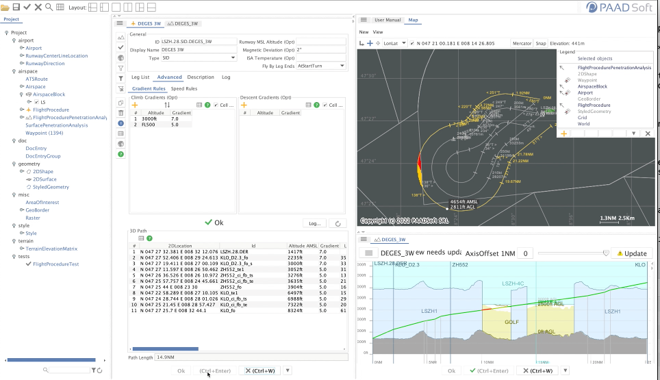
Create / edit flight procedure
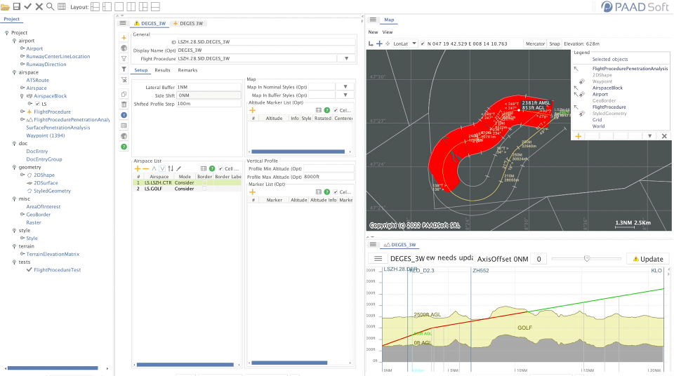
Analyse flight procedure airspace & terrain profile
Analyse route airspace & terrain profile
Analyse Minimum Vectoring Area (MVA)

Contact
For any general inquiries, please fill in the following contact form:

BACK TO TOP